Observation database file
It’s a Comma-separated values (.csv) or parquet (.parquet) file which contain observations informations. It’s used to find obs epoch and their noise.
The SQL Table inside the SQL DataBase must be named Summary.
Required keys
The required data keys are resumed in the next table :
expMJD |
filter |
fieldID |
fieldRA (rad) |
fieldDec (rad) |
noise_key |
|---|---|---|---|---|---|
Obs time in MJD |
Obs band |
The ID of the field |
Right ascension of the obs field |
De clinaison of the obs field |
The column you want to use as noise in the s imulation |
noise_key has to be defined in the configuration yaml file
If you use csv file you can define a key_dic to change columns name to corresponds to what is needed.
You can set a different zero point and its error for each observation by setting the two additional columns:
zp |
sig_zp |
|---|---|
Zero point of the observation (Optional if given in yaml) |
Uncertainty of the zeropoint (Optional if given in yaml) |
In addition you can take into account the variation of the PSF as the Full Width at Half Maximum \(FWHM = 2 \sqrt{2 \log(2)} \sigma_\mathrm{psf}\)
fwhm_psf |
|---|
The Full Width at Half Maximum of the PSF |
And you can set a different gain for each observation by giving the gain column :
gain |
|---|
The CCD gain in e-/ADU |
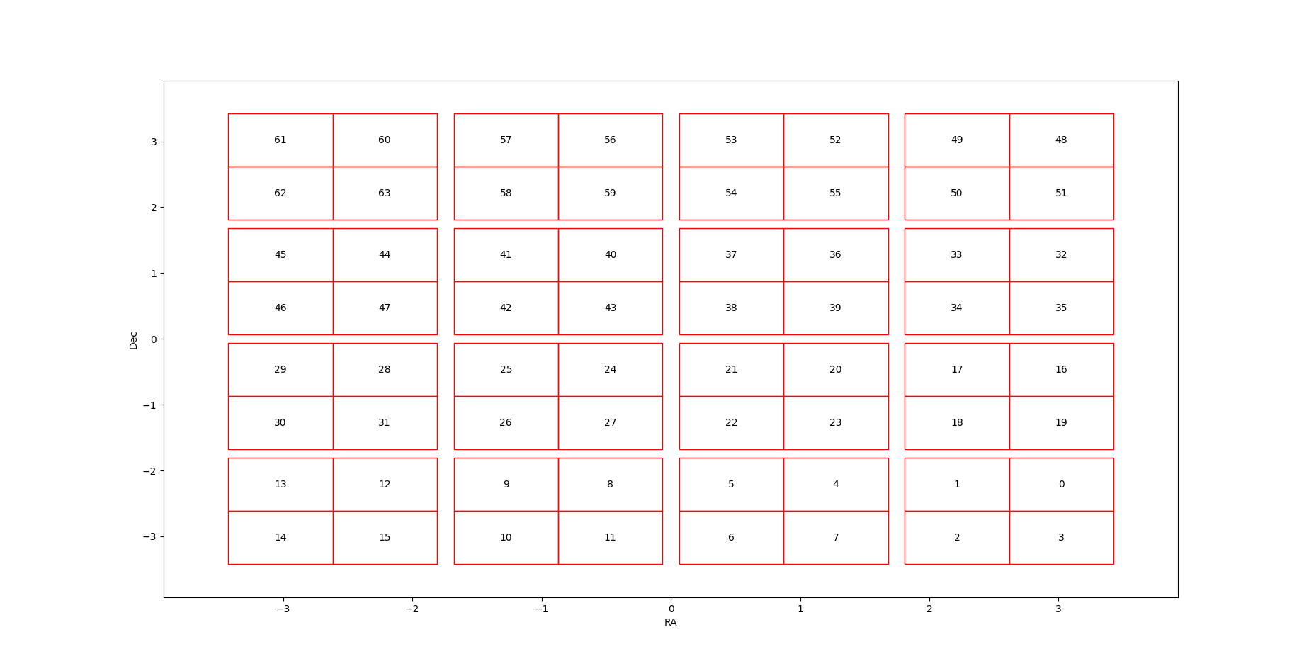
Subfields
If you want to use subfield index for observation properties or just set the geometry of the field, you have to give a .dat file that give the representation of the subfield, for example if you split your field into a 4 x 4 grid, you have to put something like that in your .dat file :
ID01:ID02:ID03:ID04
ID05:ID06:ID07:ID08
ID09:ID10:ID11:ID12
ID13:ID14:ID15:ID16
If a sub field is not observed you should set the ID value to -1.
In addition, you can add space between subfield by adding a header (begin line with %) that defines some “space-symbols”:
% #:ra:0.13
% @:dec:0.13

ID01:ID02:#:ID03:ID04
ID05:ID06:#:ID07:ID08
@
ID09:ID10:#:ID11:ID12
ID13:ID14:#:ID15:ID16
In the previous example the symbol # is used has a ra space of 0.13 degrees and the @ is used has a dec space of 0.13 degrees.
You can show the sub filed map by :
sim.survey.show_map()
show_map